 Stroudwater Navigation Ocean to Ryeford Locks
 Stroudwater Navigation Ocean to Ryeford Locks
The Stroudwater Canal is managed by SVCC and navigation information is available on their web pages HERE. Please remember that the offside canal bank (the one opposite the towpath) is usually private property.
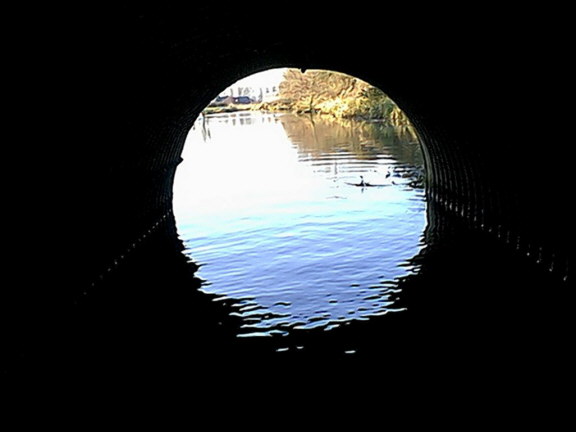 |
The Ocean Railway Bridge was infilled after the canal was closed and
represents one of the biggest obstacles to restoration on the
Stroudwater Canal. It used to only be possible for light craft to pass through the railway culvert at the Ocean (see photo). However, over the Christmas - New Year period in 2021, a new navigation bridge was installed in about a week and at a cost of about £4 million as one of the first Phase 1B projects. |
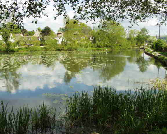 |
Beyond
the railway is the
Ocean, so named because the canal widen out
here into a large pool, and on the far side is Ocean Swing Bridge. This
is the western end of Phase 1A and the whole of the Stroudwater Canal
is navigable through to Stroud from this point. Ocean Swing Bridge is operational but can be hard work. |
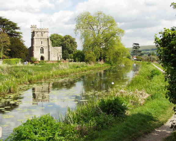 |
The next stretch is one of
the most beautiful and most photographed on
the Stroudwater as the canal swings past St Cyr's church. Part of the
graveyard was relocated when the canal was built. |
 |
Nutshell
Bridge is another original Stroudwater brick arched bridge and is
unusual in that it forms part of two other buildings, Nutshell Cottage
(west) and Nutshell House (east). The two are linked by a tunnel under
the road. Nutshell Cottage has always been just a dwelling but Nutshell
House has also served as a warehouse and traces of loading openings can
still be
seen. No evidence has been found to link these directly with the canal
company
and it is likely that they were built to serve the nearby Stanley Mill
(Grade 1 Listed). |
|
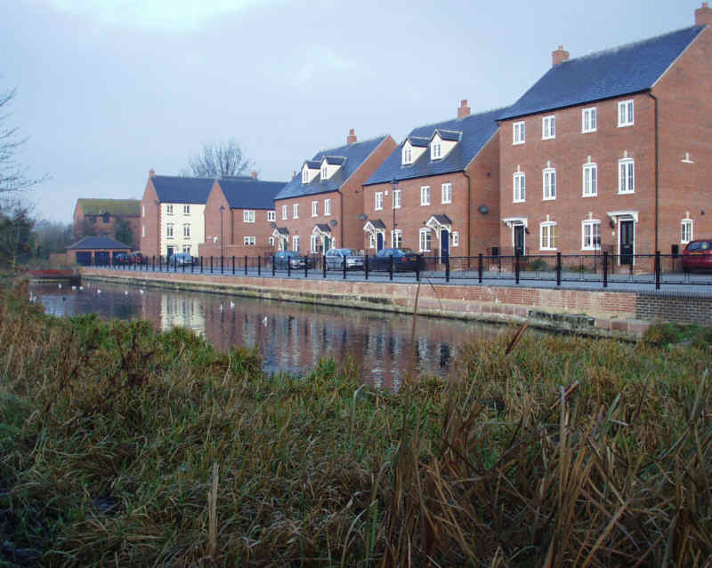
The canal passes through
housing on both sides before reaching
Stonehouse Wharf, now being redeveloped, and the new Downton Road Bridge
which was built to replace a culverted crossing. This is the
closest point to Stonehouse. A short stretch now leads to Upper Mill Bridge, This bridge was been replaced by a new fixed bridge during the course of 2010. Wycliffe School Boathouse still survives on the offside; when the canal was open, the pupils used this length of canal for rowing practice. |
 |
The canal is crossed
by an iron bridge which used to carry the
Midland Railway Stonehouse - Nailsworth line; this is now a cycle
trail. The unusual design of the bridge was the result of persistent
construction problems due
to the poor state of the ground on the offside of the canal; a problem
that
severely tested the finance of those building it. Beyond the railway is
Haywards Bridge which carries the Ebley Bypass. The canal then passes a row of cottages on the towpath side and a pair of coal pens before reaching Ryeford Bridge which has been widened significantly over its long life. Beyond the bridge the small wharf, the surrounding buildings and Ryeford Swing Bridge (restored but small boats can pass underneath) present an attractive sight. |
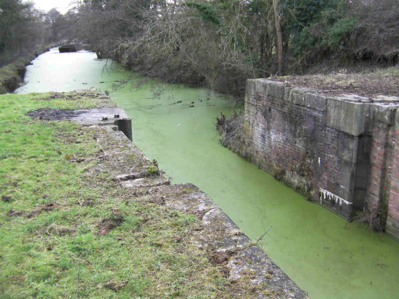 |
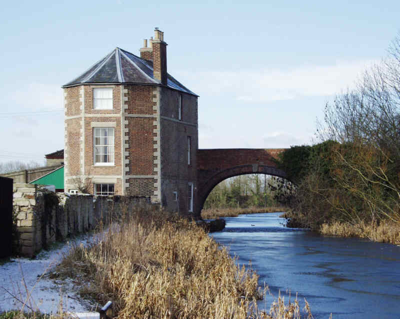
The canal now runs parallel
with the River Frome, from which it draws
its supply, with the towpath forming a narrow strip between the two. Ryeford Double Lock, now restored, marks the end of this section of the canal. The offside wall of the upper chamber collapsed following a major water main burst a few years ago and has been rebuilt. The rest of the lock was restored in 2011 and some original paddle gear remains in situ. |
Licensing Information Guide to Navigation Back to Stroudwater Index Page